 Citta
Citta Landscape
 Airport
 Island
Edinburgh: Loch Ness, Glencoe & the Scottish Highlands Tour
19.669 reviews
Buy now
From 82,32€ per person
 Attraction
 Region
 Village
 District
 Street / Square
If you’re planning a trip to Scotland, you’ll find all the points of interest, recommended destinations and other useful travel information on the interactive map featured on this page. You can view historic cities, islands, coastal villages and other tourist destinations, as well as key locations such as airports, which we cover throughout our site: simply click on the map markers or the list below to access detailed information for each point of interest.
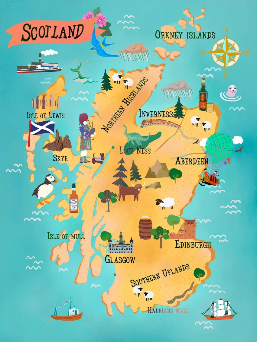
Scotland is one of the four constituent nations that make up the United Kingdom. Located in the northern part of Great Britain, it shares a border with England to the south and is surrounded by the North Sea to the east and the Atlantic Ocean to the north; it covers a total area of nearly 77,910 km² and is home to a population of over 5.4 million people.
Scotland is home to numerous cities, the largest of which is Glasgow. Situated on the River Clyde, Glasgow is Scotland’s most populous city with over 600,000 inhabitants. Edinburgh is Scotland’s second largest city and serves as the nation’s capital: it’s a vibrant and diverse city that houses the Scottish Parliament. Other significant cities in Scotland include Aberdeen and Dundee.
Scotland is also renowned for its numerous islands and archipelagos: particularly noteworthy are the Hebrides, the Orkney Islands and the Shetland Islands. Each of these island groups boasts its own distinctive culture and heritage.
Download high-resolution map Hotel
Hotel  Budget accommodations
  Apartments
  Family Hotel
  Luxury Hotel